Road Safety & Transport Planning
We build AI and geospatial systems that help transport professionals understand risk, evaluate interventions, and prioritise safety outcomes from individual intersections through to network scale.
Overview
Road safety decisions are high-stakes: budgets are limited, constraints are real, and outcomes matter. We help agencies and planners move beyond fragmented analysis by combining advanced AI with geospatial systems to deliver a unified picture of risk and opportunity.
- Risk modelling from intersection to corridor to network
- Scenario evaluation and intervention prioritisation
- GIS-native insights designed for operational users
- Evidence-backed outputs for planning and reporting
ViaRisk
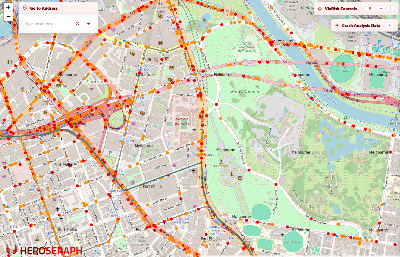
Our flagship platform, ViaRisk, combines advanced geospatial modelling and analysis capabilities with HeroSeraph's proprietary AI models to analyse and predict a range of risks in the road network.
ViaRisk
ViaRisk gives transport safety teams a practical way to identify and justify road-safety interventions. It brings together AI risk modelling, crash data, road context, spatial selection, ranked tabular analysis, and automated reporting in one secure GIS-based AI platform.
The value is not just seeing where crashes happened - it is understanding where risk is concentrated, where intervention should be prioritised, and how to communicate that evidence to decision-makers.
ViaRisk brings HeroSeraph's AI models, a wide range of data sources, mapping systems, and workflow into one environment so transport planning professionals can move from initial surveying to prioritised actions without stitching together multiple tools.
ViaRisk provides an AI-integrated geospatial portal for rapid exploration and insight, predictive risk scoring and comparison across locations and corridors, and support for scenario testing and program evaluation - all designed from the ground up for road safety and transport planning professionals.
A complete, integrated solution for risk analysis
ViaRisk empowers your road safety and transport planning experts' workflows end-to-end. Because our software is fully developed in-house at HeroSeraph, we can also develop tailored and bespoke solutions for your specific transport planning needs.
Geospatial risk analysis
GIS-native workflows to explore risk distribution throughout your road network.
Program evaluation
Measure and compare risk profiles in support of treatment prioritisation.
Purpose-built AI models
Select from a range of models designed to excel in different road safety contexts and use them to gain insight into the different risks in your jurisdiction.
BYO data
Integrate your own data into ViaRisk and synthesise it with our AI models.
Simulation & modelling
Test scenarios and impacts before committing budget and operational change.
Decision-ready reporting
Clear outputs aligned to planning, governance, and stakeholder needs.
Ready to discuss a road safety program or platform?
We work with road safety and transport planning teams to design practical systems that fit your operational needs.